

将shp文件转换为cesium可以加载的geojson文件,在线转换工具,使用cesium的GeoJsonDataSource接口类,根据建筑物高度上色加载geojson文件。
注意shp文件包含_Height字段。
代码如下:
<!DOCTYPE html>
<html lang="en">
  <head>
    <meta charset="utf-8" />
    <meta http-equiv="X-UA-Compatible" content="IE=edge" />
    <meta
      name="viewport"
      content="width=device-width, initial-scale=1, maximum-scale=1, minimum-scale=1, user-scalable=no"
    />
    <meta name="description" content="Load GeoJSON or TopoJSON data and apply custom styling.">
    <meta name="cesium-sandcastle-labels" content="Showcases, Tutorials, DataSources">
    <title>Cesium Demo</title>
    <script type="text/javascript" src="../Sandcastle-header.js"></script>
    <script type="module" src="../load-cesium-es6.js"></script>
  </head>
  <body
    class="sandcastle-loading"
    data-sandcastle-bucket="bucket-requirejs.html"
  >
<style>
      @import url(bucket.css);
      html,
      body,
    #cesiumContainer {
      width: 100%;
      height: 100%;
      margin: 0;
      padding: 0;
      overflow: hidden;
    }
    </style>
    <div id="cesiumContainer" class="fullSize"></div>
    <div id="loadingOverlay"><h1>Loading...</h1></div>
    <div id="toolbar"></div>
    <script id="cesium_sandcastle_script">
window.startup = async function (Cesium) {
    'use strict';
//Sandcastle_Begin
const viewer = new Cesium.Viewer("cesiumContainer", {
      timeline:false,
        animation:false,
        infoBox:false,
        imageryProvider: new Cesium.WebMapTileServiceImageryProvider({
            url: "http://t0.tianditu.gov.cn/vec_w/wmts?tk=ec5a2a0e05d6e7be9aabdcfa8a8812a9" ,
            layer: "vec",
            style: "default",
            tileMatrixSetID: "w",
            format: "tiles",
            maximumLevel: 18,
        }),
    });

//Example 1: Load with default styling.
Sandcastle.addDefaultToolbarButton("Default styling", function () {
  viewer.dataSources.add(
    Cesium.GeoJsonDataSource.load(
      "../ZhongXBuildings.json"
    )
  );
});

//Example 2: Load with basic styling options.
Sandcastle.addToolbarButton("Basic styling", function () {
  viewer.dataSources.add(
    Cesium.GeoJsonDataSource.load(
      "../ZhongXBuildings.json",
      {
        stroke: Cesium.Color.HOTPINK,
        fill: Cesium.Color.PINK.withAlpha(0.5),
        strokeWidth: 3,
      }
    )
  );
});

//Example 3: Apply custom graphics after load.
Sandcastle.addToolbarButton("Custom styling", function () {
  //Seed the random number generator for repeatable results.
  Cesium.Math.setRandomNumberSeed(0);
  var geojsonOptions = {
    clampToGround : true //使数据贴地
          };
        // 加载tileset.json
       var entities;
        var promise =Cesium.GeoJsonDataSource.load('../ZhongXBuildings.json', geojsonOptions);
        promise.then(function (dataSource)  {
            viewer.dataSources.add(dataSource);
            entities =dataSource.entities.values;
            viewer.zoomTo(entities);
            for (var i = 0; i < entities.length;i++) {
                var entity = entities[i];
                const { properties, polygon } = entity
                var lvalue = entity.properties._Height._value;
                var color;
                if(lvalue<10){
                    color = "151,232,173";
                }
                else if(lvalue>=10&&lvalue<20){
                    color = "0,0,255";
                }
                else if(lvalue>=20&&lvalue<30){
                    color = "247,180,45";
                }
                else if(lvalue>=30&&lvalue<45){
                    color = "241,147,3";
                }
                else if(lvalue>=45&&lvalue<60){
                    color = "239,117,17";
                }
                else if(lvalue>=60&&lvalue<70){
                    color = "238,88,31";
                }
                else if(lvalue>=70&&lvalue<80){
                    color = "224,63,22";
                }
                else{
                    color = "208,36,14";
                }
                entity.polygon.material = Cesium.Color.fromCssColorString("rgb("+color+")");;
               //Remove the outlines.
                entity.polygon.outline = true;
                entity.polygon.extrudedHeight = lvalue;
            }
            const x = 120.9, y = 32.0348739
            viewer.camera.flyTo({destination: Cesium.Cartesian3.fromDegrees(x, y, 3000),
    });
        })
      });
//Reset the scene when switching demos.
Sandcastle.reset = function () {
  viewer.dataSources.removeAll();
}
  Sandcastle.finishedLoading();
};
  if (typeof Cesium !== 'undefined') {
    window.startupCalled = true;
    window.startup(Cesium).catch((error) => {
      "use strict";
      console.error(error);
    });
}
</script>
</body>
</html>
结果: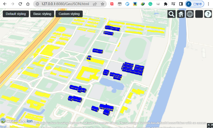
开始因为shp数据是从eps中导出的,存在一个建筑导出多个重叠面的情况,还有自相交的拓扑错误,修复之后如下:
参考:
")


评论(0)
您还未登录,请登录后发表或查看评论